Hello,
I noticed an incorrect elevation profile in ABRP for the Great St Bernard Tunnel between Switzerland and Italy.
ABRP appears to use the terrain elevation above the tunnel, showing the route climbing to approximately 2,600 m before descending again.
The actual tunnel elevations are:
North portal (Switzerland): 1,918 m
South portal (Italy): 1,875 m
Tunnel length: 5,798 m
Actual elevation difference: −43 m
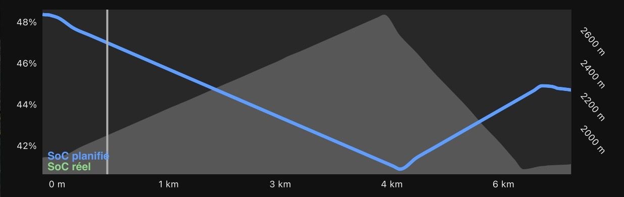
Could you please check and correct the elevation data used for this tunnel?
Thank you.