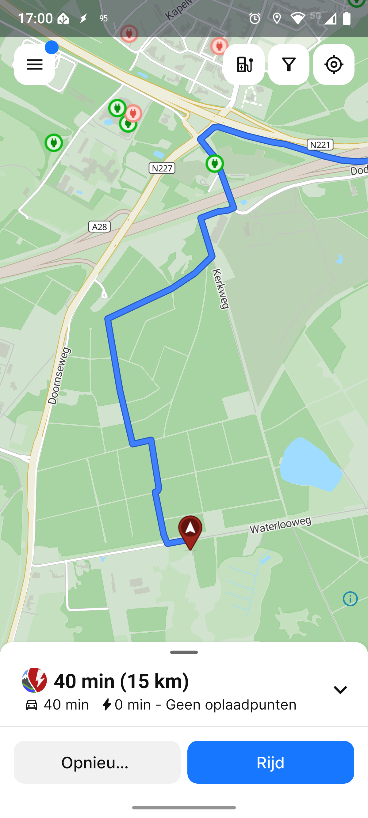
40 minute route for 15km drive
When I use abrp to plan a route from this parking lot (52.11961, 5.38250) to home (
52.20967, 5.41444, not my exact address) it will plan a route that takes over 40 minutes and will go over dirt roads that are actually forbidden for cars.
So 2 things go wrong:
by taking a route that is exactly the same distance, it's only a 15 minute drive. Why does abrp prefer the 40 minute drive?
How come it plans a route over a horse-riding path. In the Netherlands it is forbidden to drive your car there
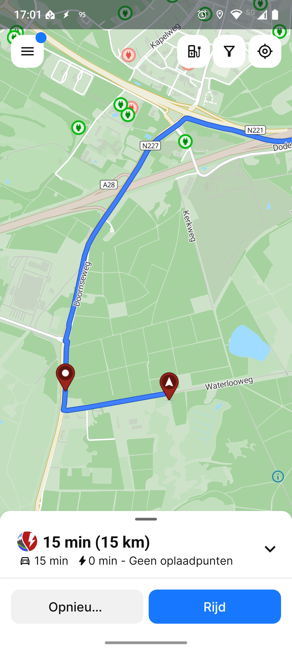
In this case I know there's a better route than abrp plans, but how can I trust any route it plans when I'm not familiar with the area?
Log in to comment and vote
Comments3
Mar 3, 2025
PinnedHi,
Please provide a link to the plan where this occurs. To do this;
Plan the trip in ABRP
Click/tap: ‘Share plan’
Click/tap: ‘Share ABRP link’
Paste the URL here
IMPORTANT: Please exclude private addresses and the use of ‘my position’, home, work etc. from the plan you post here publically.
Dick
Mar 3, 2025
Here's a link to the plan:
https://abetterrouteplanner.com?plan_uuid=594030c1-90e5-40c5-9182-5ea8bb4b4f79
And this is a plan with an extra waypoint added to force the proper route:
https://abetterrouteplanner.com?plan_uuid=8b7cc234-2a1f-4100-95d3-f29ecf7803a8
Katya S.
Mar 3, 2025
Thank you.
I can see that this road is tagged as a track road, which we generally avoid, but in this case, it is not tagged with allowed access; motor vehicles=no and therefore the routing engine does consider it drivable with.
I can see that you have to make use of ‘Doornseweg’ in order to get onto ‘Waterlooweg’ in your preferred version of the route. The tags that ‘Doornseweg’ carries is what prevent us from making use of it, unless you either start from it or end on it
https://www.openstreetmap.org/way/780995050#map=19/52.120525/5.363270 The routing engine tries to avoid entering the road with:
motor_vehicle: destinationRoads with such tags are heavily penalized and strongly avoided in routing as it could likely make for illegal routing, and therefore, looking at the surrounding alternatives, the routing engine chooses to make sure of the track road as it is not clear that motor vehicles are prohibited.
Due to it being a road of poor quality, we’ll estimate a very low speed and the driving time will be significantly longer.
If any of this sounds incorrect, it can be corrected over at:
https://www.openstreetmap.org/edit